Features
Everything you need for accurate, verified, and professional GPS tagging
Features
Features
Everything you need for accurate, verified, and professional GPS tagging
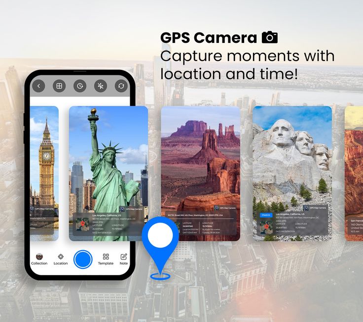
Real-Time GPS Tagging
- Automatically captures latitude, longitude, altitude, and address.
- Works with high accuracy using your device’s GPS and network location.
- Works seamlessly across multiple devices and environments.
- Adjustable precision mode for high or low GPS sensitivity
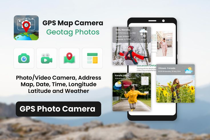
Date & Time Stamp
- Embeds exact date and time (in any time zone)
- Useful for proof-of-visit, fieldwork logs, or reporting tasks.
- Syncs automatically with your device clock or network time.
- Supports multiple time zone formats for international users.
Map View on Photos
- Adds a mini Google Map or address overlay directly on the photo..
- Choose from multiple map styles (Normal, Satellite, Hybrid, Terrain)
- Automatic reverse-geocoding to display location name and area.
- Add a live Google Map or location label directly on your captured photos.
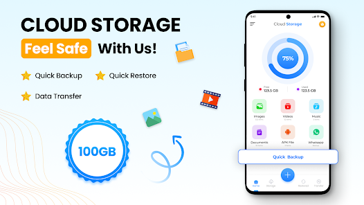
Cloud Storage & Backup
- Upload images instantly to a secure cloud platform
- Access your data anywhere and manage it easily from your dashboard..
- Organize files by date, location, or project for quick retrieval.
- Automatic backup prevents accidental data loss..
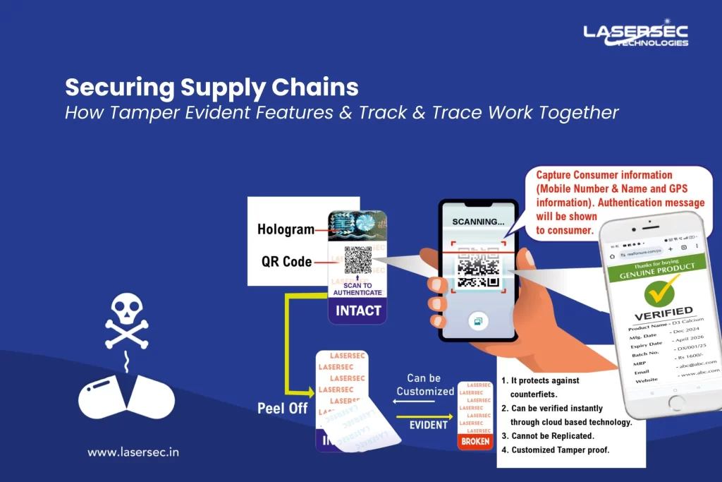
Tamper-Proof Verification
- Locked metadata ensures authenticity — prevents altering GPS/time data.
- Ideal for audits, compliance, and field inspections
- Ideal for inspections, audits, and field verification reports.
- Watermark verification code confirms original capture details..
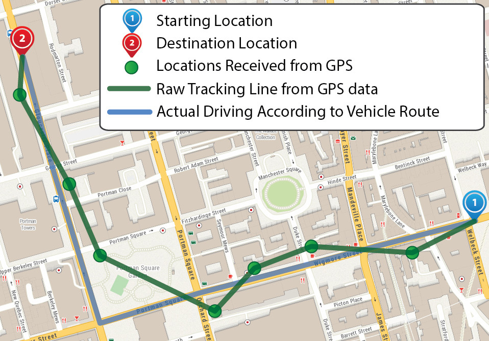
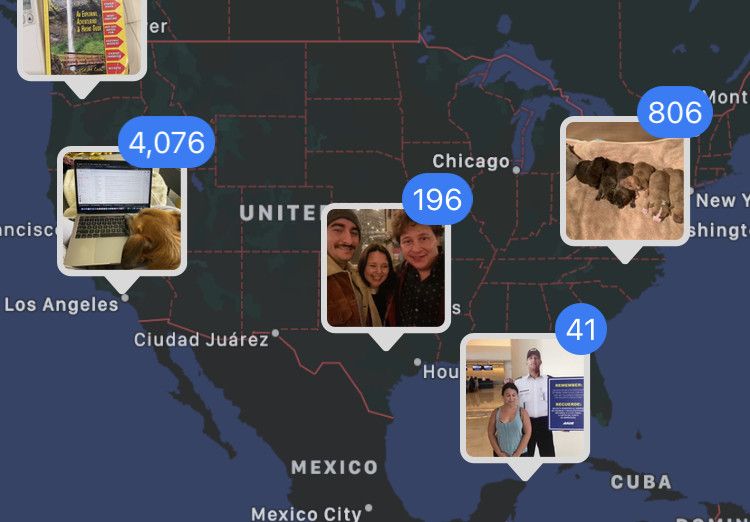
Route Tracking
- Export route data in formats like GPX, KML, or CSV
- Monitor total distance, time spent, and visited checkpoints.
- Track and visualize your travel path on a live map..
- Export data as reports or share routes with your team.